C20-2024-010 University Neighborhood Overlay (UNO) Update
C20-2024-010 University Neighborhood Overlay (UNO) Update
About
Amendments to City Code Title 25 (Land Development) to modify the University Neighborhood Overlay (UNO), including height allowances, uses, affordability requirements, district boundaries, parking standards, and design criteria.
Overview
UNO Overview
The University Neighborhood Overlay or UNO was first adopted in 2004 to promote high-density, pedestrian-oriented redevelopment of the West Campus area in a manner that maintains the area's existing character. The overlay overrides certain site development standards and allows land uses to encourage development that serves the primarily student population of the area. This includes reduced required parking spaces, increased maximum allowable building height and bulk, and allowance for a mix of local, pedestrian-serving commercial uses. For a property to qualify to develop under UNO, additional requirements must be met including the provision of affordable housing and adherence to stricter streetscape and design standards. These regulations were crafted through a robust community process involving area residents and stakeholders.
Since the adoption of UNO, the overlay has facilitated a population growth to over 28,000 residents in the West Campus area, significantly shaping the housing experience for thousands of students. UNO has spurred the creation of 972 income-restricted bedrooms and 401 income-restricted units since 2004. Research from the Housing Department suggests that the increase in supply near campus has helped shield market-rate units from the intense rent growth seen across Austin. The design standards have also contributed to a safer, more walkable neighborhood, reducing the likelihood of pedestrian accidents. The Parking Benefits District, created by the addition of metered on-street parking, has further supported roadway improvement projects, such as sidewalks, curb ramps, and bicycle lanes that promote walking, cycling, and transit use.
This map shows the UNO boundary in orange, with aerial imagery from 2003 on the left and current imagery on the right. Use the swipe tool to view the change over time.
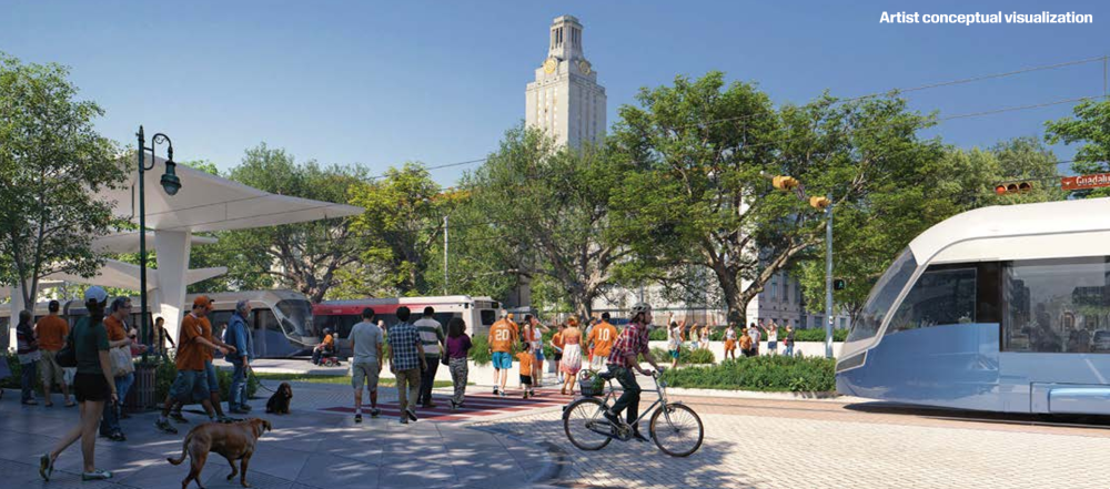
In 2020, voters approved a local funding source for Project Connect, a mass transit plan that includes Austin’s first light rail system. In 2023, the Austin Transit Partnership adopted the Phase 1 light rail alignment, which includes the initial route recommendations for light rail. This investment plan outlines two transit stops serving UT and the surrounding West Campus community. The City anticipates new development to take place adjacent to the new and improved transit options. The City is actively updating and creating new zoning regulations along the light rail route to guide the anticipated development. This includes increasing development entitlements to ensure that more people have access to the improved transit options. Council reaffirmed this commitment to increased housing opportunities and transit access by including a call for a community-oriented planning process in their April 2024 Resolution requesting updates to the University Neighborhood Overlay.
Public Hearing Information and Timeline
Public hearings are an opportunity to have your voice heard on proposed changes to the Land Development Code.